After hitting the east coast, my farthest eastern point, it was time to head back west. I still had two more destinations to go, so across North Carolina I went, till I finally hit the mountains. As I drove the roads began to wind more and the temperature began to drop.
As was my intention, I did a minimal amount of planning,this was my intention. This leg of the journey almost turned into a disaster as I entered Great Smokey Mountain National Park. The park enc0mpasses some 30 miles east west. It's a gigantic amount of land with hundreds of hiking trails including many that lead straight to the Appalachian trail itself.
While I knew there were camp sites in this park, I didn't know where they were. I drove up the mountains and finally hit the Tennessee North Carolina border. The border sits at the top of the pass crossing the mountains. And boy was it cold. The temperature gauge hit near 40 and I started to hear rumors of snow on the pass as I continually got out to take pictures. With a little extra time on hand, my curiosity peaked as I decided to drive up to the closest lookout tower I could find. Which just so happend to be THE highest point in the park: Clingmans Dome. As I wound up the mountain my temperature gauge began to plummet. It hit 32 when it started to snow.
Dear reader, you have to realize how scared and nervous I was this entire trip. I left on this trip with almost zero planning, just vague destinations and only basic essential gear. Also, I am from Texas. When it snows in Austin, the whole city shuts down and wrecks ensue.
 The snow began getting thicker and thicker, and I little fears began creeping in my head, like 'what if I fall off the mountain? or 'are my tires going to lose grip?'. These were unfounded and ridiculous I REALIZE. I just kept thinking about what my mom would say if I died because I made a stupid decision. It's around the time this guilt sunk in and I decided to turn around. As I later would find out had I driven another 5 minutes I would have made it to the top, where PLENTY of people were right now.
I finally came to an information center and was informed that the nearest campground to me was only about 5 miles away. I overheard the park ranger reporting that the nearby town of Gatlinberg expected 32 degree temperatures tonight. My campsite would be at a higher elevation than this, thus colder.
'GREAT!' I thought.
'Good thing I brought a leather jacket' (this is sarcasm)
Truthfully I wasn't sure how this would turn out. A little over a week ago I was sweating on the beach of South Padre Island. Now I was going to die of frostbite in the mountains of Tennessee. Texas' fall includes 90 degree temperatures, and the first cold front usually doesn't come in till the end of October. Until now I had enjoyed a string of beautiful temperate temperatures. Nights of 50 and days of 70.
'Oh well.' I said to myself, 'As my favorite motto goes: Fuck it'.
So I left for my campsite. After another 15 minutes I landed, bought some firewood, and set up my camp.
The Great Smokey Mountains are the most popular national park in the US. With the highest annual visitors, feeding the economies of atleast 4 towns surrounding the park. When I took this trip I figured I would be completely alone, being that I was mainly camping during the week day, and the middle of October. What I found throughout my trip was, except for the hidden treasure that is Congaree National Park, most parks were fairly populated. Great Smokey Mountains was byfar the most with atleast 70% capacity at my campground. Being an anti-socialite during this trip (I did go looking to find difficult answers in the solitude of nature) this was a definite downgrade for me. But I managed the screaming kids and barking dogs in the campground for the few hours I was at my campsite. I tired quickly of the constant 'hello's' I had to give. (I was raised in small town in the South remember) I found that many people didn't respond to these, and mainly ignored me. I felt obligated to say hello regardless and maintain eye contact! Tis polite.
It's good to note the fairly obvious fact that these are the mountains of the eastern United States. Anyone I met or license plates I saw were from the East, from Maine to Alabama. Although the distance is near the same from Texas to the Appalachians and to Colorado, every Texan goes to Colorado. Anyone that's been knows it's like a Texas reunion in Colorado. Which is the way it should be. This was like a north eastern reunion, and I felt slightly out of place. As far as hiking goes, GSM is amazing. But the Rockies literally dwarf the Appalachian mountains. The Rockies highest peak is more than DOUBLE that of the Appalachians (6.6k feet versus 14k feet). No I'm not going to change that metric/standard mix I just did. I believe in diversity. Especially in science. (quite sarcastic)
The smokies were amazing. And definitely a destination any hiker should visit.
It's hard to truly understand the amount if trails in GSM. You could get lost for a month wandering around the entire park, taking every seemingly forgotten trail. Every trail has its own hidden gem, and any not on the popular list will take you to their own unique silent solitude.
 If you add the Appalachain Trail, a +3000 mile trail stretching the entire length of the Mountains, well your mind begins to explode from the size. Because of the amount of people that visit the park annually, you unfortunately can't travel on any trail expecting not to run into someone. There will always be someone somewhere.
 The Great Smoky Mountains are named because the blue haze that covers the mountain range. You'll notice this on any distance shot you take. This comes from the moisture moving up from the Gulf of Mexico, rising above the mountains, and coalescing into this endless haze.
 The park is also famous for it's black bear population, containing the densest population of black bears in the United States. People come from all around for their chance to see a black bear. Numerous signs are posted warning you about them. The fact they only have rarely ever had a bear attack is due in large part to the parks constant vigilance to educate the public on them. 'Don't feed the bears', 'Did you kill this bear?', 'Beware bears!' signs are posted everywhere. One of these includes a long explanation about the most recent bear attack. Apparently some woman brought an entire fast food thing of fried chicken into the woods and just left it on the side of the trail. On her way back down the trail she ran into a bear (surprise!). This is not that abnormal, the problem was the woman let the bear come up to her. There is, I shit you not, a picture from her cellphone, of the bear sniffing her. And amazingly the bear attacked her (sarcasm again). She left with some scratches or bite marks on one of her arms, and the bear was killed. So the reason I didn't run into a bear on my journey was because I didn't stop first at KFC. Had I only known. Damn.
 Back at my campsite. I built a fire. Finding I never brought a lighter, I resorted to using the burner on my camp stove. Abra Kadabra, I had conquered nature. Fire! So for the rest of the night I sat trying to warm up by the fire. My old boots had flooded when I hiked through the flooded paths of North Carolina and were still sopping wet. In a desperate move I decided to warm them by the fire. The best part of this is watching them 'smoke' while they attempt to dry.
By morning they had only half dried, and I resorted to covering my feet in plastic bags (which does work btw)
 Finding I also never brought a can opener, I resorted to opening my can of beans with my knife. A very easy prospect, and kinda satisfying. Conquering modern life with a pioneer spirit (that was corny I understand, but it's the little wins that make you the most happy).
With dinner done I climbed into my bed, and went to sleep...NOT. It was freaking freezing. I bundled myself into the tightest ball I could find and used both blankets while trying to go to sleep.
AGAIN! It's time to admit something I hate to admit. My mother (yes I'm going to use the spiteful 'mother') was right. I was not the least bit prepared for sleeping in the cold. I brought a 2 blankets instead of a sleeping bag. Neither which of these have any sort of cold rating. I put on my hoodie and jeans, and attempted to sleep.
It is only by the grace of god I lived through that night (maleodramatic). I woke up in the morning shivering, my body temperature very low. I threw on my jacket, made coffee as fast I could (warming my hands with the fire from the burner), and jumped in my car. Turning the heat on full blast, I began driving to a nearby hiking trail crossroad, and didn't leave the car till my core had heated back up.
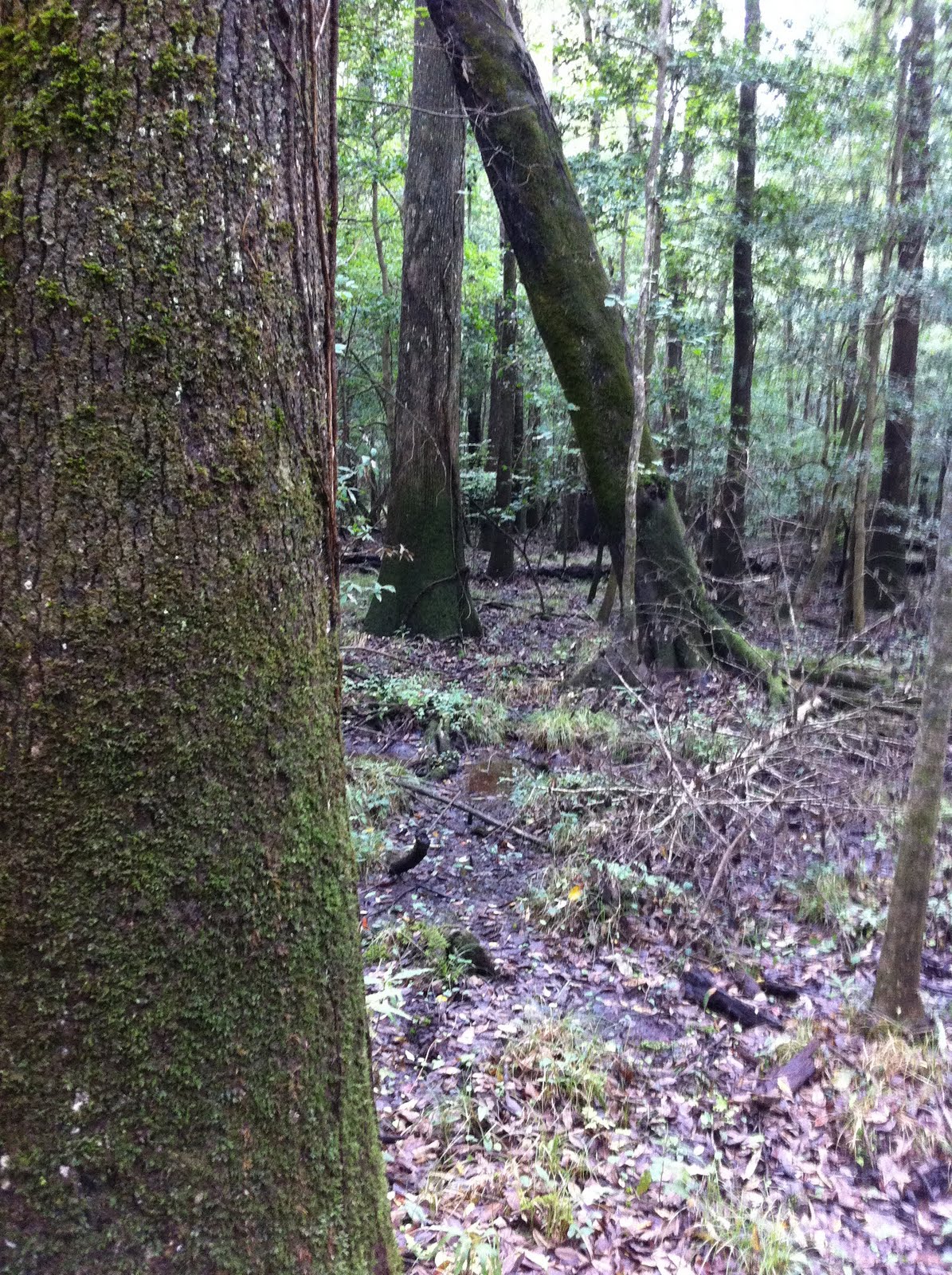
I began my hike around 9am and wound my way up a trail that no one else was taking. This trail was beautiful, especially at the lower elevation portions. I came across many birds through the trip, from beautiful sounding thrushes to running into an amazing mixed-species flock. A mixed species flock is a common tactic by birds and especially migrating birds. Usually easy to find because of the loud chickadees and titmice. Multiple species of birds forage in a wave across a given habitat. Sometimes coming and going quickly. It's any these you can find many new birds. Just listen for the Chickadees. It's in this I found many warblers in their fall plumage, this dull plumage is harder to identify. I managed to identify the Cape May Warbler, Blackburnian Warbler, and unfortunately the Yellow-rumped Warbler. Unfortunate because this is the prominent warbler in the Texas Winter, and one you get very tired of seeing. I drive 2000 miles and what do I find? The same damn bird I see 6 months out of the year. It's possible these yellow-rumps were migrating down the mountains to come straight to my current back yard in New Braunfels, TX. IT'S POSSIBLE. Very unlikely. But possible.
 As I mentioned earlier in my rant about how packed GSM is. After hiking on a seemingly barren trail for 2 hours I ran into a couple heading back. The only good thing about this was I never grabbed a good trail map and was essentially hiking blind. I had a very under detailed map that didn't have all the trails on it. So the fact people were there, I knew I wasn't lost and I had taken the correct forks (yes there were forks).
The end of this particular trail came another hour later, culminating at a beautiful river sitting at the bottom of the valley. So with a few pictures taken, I headed back.
 And three more hours later I came back to the parking lot. My hike taking me 10 miles. With a little sunlight left, I headed across the parking lot to the very popular and concreted trail leading to a local waterfall. This trail was a letdown, while it had trail markers with fun facts about the surrounding environment, the waterfall was underwhelming. The 10 mile hike I had just taken was more beautiful and less packed. So back at the car, 12 miles, 7 hours. My knees were killing me, I was starving, but I had one last plan for the day. So with that I took a trip back to Clingmanns Dome.
As I ascended the elevation it once again grew colder. This time it did not snow. Once at the top, my thermometer hit 30 degrees and the wind was blowing. I made it with barely a minute to spare, as I ran to the mountain side with every other spectator. And there, 6,600 feet above sea level, 30 degrees, I watched the sun literally blink away under the mountains. It was amazing.


Back at camp, I was forced to make dinner in the dark, cold. I showed up too late to buy more firewood. I decided to retire early and read. But this time I decided to fight the cold back.
-Warning. The following will be very ridiculous. If you are one that likes to live in normality do not read on-
I made up my mind. I wore a short sleeved shirt, long sleeved shirt, my gloves, and my hoodie. On bottom I put on two pairs of jeans. I covered myself with my jacket, put my towel over my legs, and then used the 2 blankets I had. It should also probably be noted, I am a wussy for cold. I have the internal temperature of a salamander. But the important thing is I SURVIVED. I am a winner. I beat the cold. And early that next morning, I packed my stuff up and drove out of Great Smokey Mountain National Park.
The ridiculous part about GSM being the most visited park in the US is that every town surrounding it becomes a giant tourist trap. I have never seen such tourist nonsense. Small parks, Ripleys believe it or not, freak shows, family shows, every sort of themed restraunt and store. It was disgusting. These weren't just towns where you could buy crap with bears and "GREAT SMOKEY MOUNTAIN NATIONAL PARK" written on it. These were capitalist theme parks, thinly disguised as towns.
Yes, I did stop at a restraunt in one of these towns. Yes I did buy some pancakes called the "Smokey Mountain Breakfast Special" Yes it was delicious. And yes this place was covered in silly cartoon bears and a gift shop. Don't judge me reader.


